Subject: English Channel, England, France
Period: 1770 (circa)
Publication:
Color: Black & White
Size:
27.6 x 18.5 inches
70.1 x 47 cm
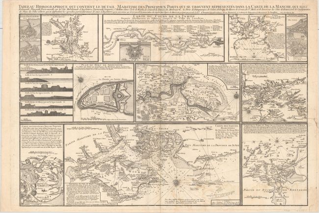
This uncommon and highly detailed sheet includes a number of charts, plans, and profiles showing ports and fortifications along the English Channel. The largest of the eight charts centers on the Isle of Wight and extends to the coastline to the north of the island. Other charts focus on the Thames near London, Plymouth Sound, and the regions around Brest and Saint-Malo, among other locations. These charts feature place names, anchorages, hazards, soundings, topographical detail, and more. There are small plans for six fortifications, including Dunkirk and Calais. The fort of Sheerness is depicted in a larger plan and in a series of profile views. Extensive notes in French text appear throughout.
References:
Condition: B+
A nice impression on a watermarked sheet with light damp stains at bottom right, minor toning along the centerfold, and some minute worm holes around the centerfold. A tear entering 2" into map at right has been closed on verso with old paper.