Subject: London, England
Period: 1862 (published)
Publication:
Color: Black & White
Size:
31.7 x 24.1 inches
80.5 x 61.2 cm
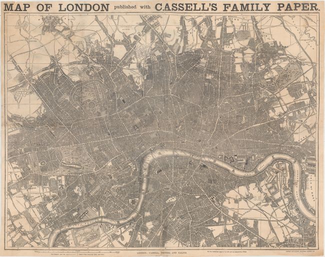
This large, detailed map of greater London was produced for the World's Fair of 1862 and covers the region from Kensington east to the West India Docks and from Hampstead south to Walworth. It is filled with detail, showing boroughs, streets, parks, railways, canals, docks, gardens, and more. Among the sites of interest located are St. Paul's Cathedral, the Houses of Parliament, Westminster Abbey, London Bridge, and Buckingham Palace. It was produced by the firm of Cassell, Petter and Galpin as a supplement to Cassell's Family Paper. According to its publishers, "by the use of this map, visitors to the Great International Exhibition, even though entire strangers, will be able to find their way in every part of London." The map was available for sale for the price of one pence on May 5th, 1862 to those who had purchased the preceding three issues of the paper (#231-#233). Drawn on a scale of a quarter mile per inch.
John Cassell was a London publisher active during the middle part of the 19th century. In the 1850s, the business was acquired by Thomas Galpin and George Petter, although Cassell remained with the firm.
References:
Condition: B
A dark impression with light surface soil mainly at top left. Professionally backed with tissue to reinforce and repair numerous short separations and edge tears resulting in minute loss in several places.