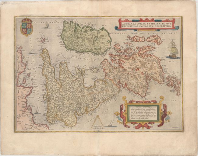
Subject: Britain
Period: 1570 (circa)
Publication: Theatrum Orbis Terrarum
Color: Hand Color
Size:
19.7 x 13.6 inches
50 x 34.5 cm
This map, based on the cartography of Gerard Mercator, is Ortelius' earliest map of Britain. Flemish influence, or possibly a mistranslation, is evident in the rendering of some of the place names, e.g. Ormyskyrk for Ormskirk, Dantre for Daventry, and the omission of the relatively important Peterborough. Distinguished by a sophisticated style of engraving, the map is embellished with two ornate strapwork cartouches, the royal coat of arms of the UK, dividers and distance scale and five sailing ships. Latin text on verso.
The verso text on this example does not match any of the editions cited by Van den Broecke, but most closely resembles those of the 1570 Latin editions.
References: Shirley (MCC-94) #86, pl. 42; Van den Broecke #16.
Condition: B+
Watermarked paper with light soiling and professional repairs to several separations along the centerfold.