Subject: Europe
Period: 1850 (circa)
Publication: Illustrated Atlas and Modern History of the World
Color: Hand Color
The maps from The Illustrated Atlas were first published in serial form to a target audience that led insular lives due to the expense and hardship of travel. All that changed as the progress of the nineteenth century brought swift and dramatic changes in public awareness of far away places. Tallis' maps no doubt played an important role in this dramatic awakening. These maps not only provided up-to-date geographical knowledge, but also used vignette views within the map's design to show the native people and their occupations, cities and points of interest. The maps hark back to a cartographic tradition from the Dutch mapmakers of the seventeenth century with finely engraved decorative borders. The maps were drawn and engraved by John Rapkin with views drawn and engraved by a number of prominent artists. The maps were issued as a complete volume from 1851 until about 1865. Some of the maps were also published in other history books published by Tallis including British Colonies and, without the vignettes, in geographical dictionaries and encyclopedias until about 1880.
This lot of nine steel engraved maps is focused on European countries as well as one map of the continent. Each of the maps is surrounded by a decorative border and embellished by a series of vignettes depicting both people and places. The decorative borders and vignettes are uncolored, as issued.
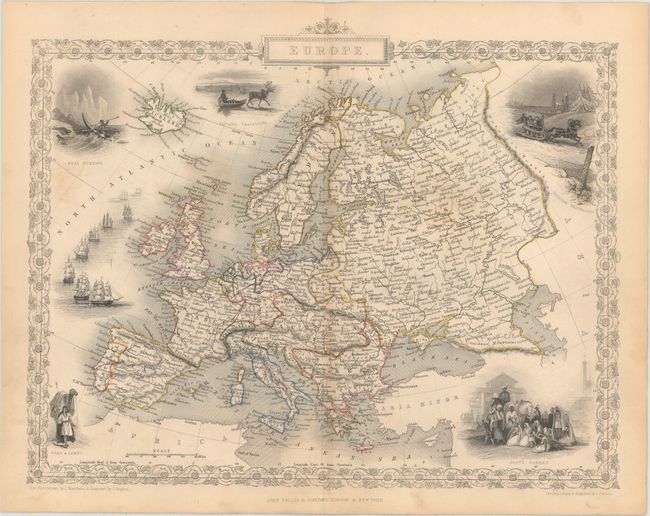
A. Europe, (12.6 x 10.0"). Map extends to the Ural Mountains in Russia and includes Iceland, all of Scandinavia, and the Black and Caspian Seas and Caucasus region. The well rendered vignettes include Seal Hunting, Lapland Travellers (reindeer), Russian Travellers, Arab & Camel, and the Slave Market.
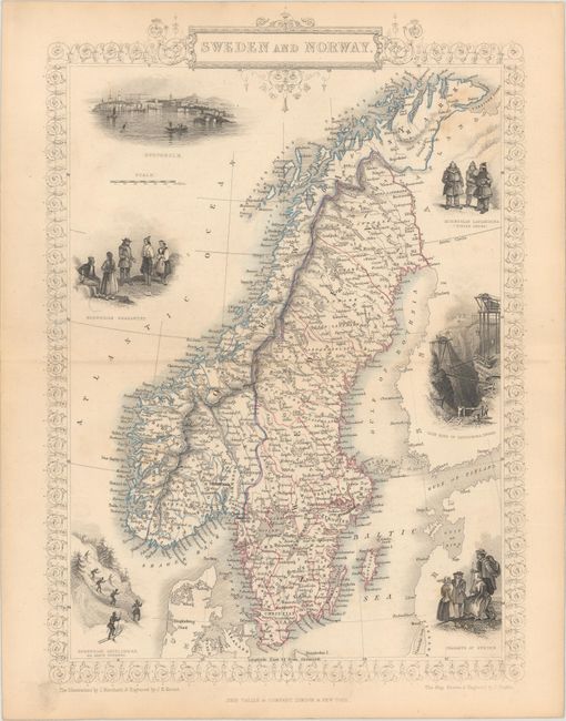
B. Sweden and Norway, (9.5 x 13.4"). Includes six interesting vignettes of the people and countryside with an especially nice view of Stockholm, as well as one showing skiers, here called Skate Runners.
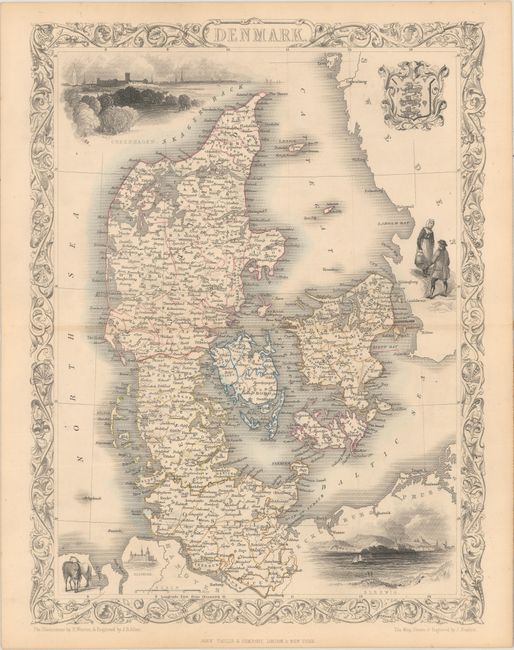
C. Denmark, (9.9 x 13.1"). Vignettes feature Copenhagen, the royal crest of Sleswig, Elsinore, people in native costume, and horses.
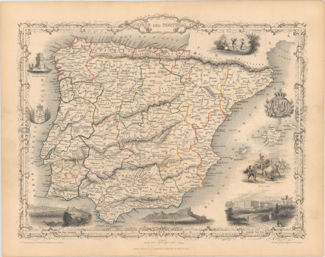
D. Spain and Portugal, (12.6 x 9.7"). A nice map of the region surrounded by eight artistically rendered vignettes; Bull Fight, Belem Castle, fine bird's-eye views of Lisbon, Gibraltar, and Madrid, and two coats of arms.
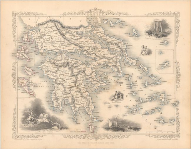
E. Ionian Isles and Greece, (12.4 x 9.8"). This handsome and decorative map is embellished with fine vignettes showing an Ancient War Chariot; Greek Corsairs off Corfu; a Modern Greek man; the Temple of Jupiter Olympus at Athens, and two wrestlers. The map covers all of Greece including its numerous islands. With inset maps of Corfu, and Stampalia.
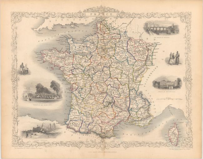
F. France, (12.4 x 10.0"). Surrounded by six vignettes including: Garden of the Palais Royal, Calais Harbour, the Bridge of Toulouse, Palace of Fontainebleau, and native people.
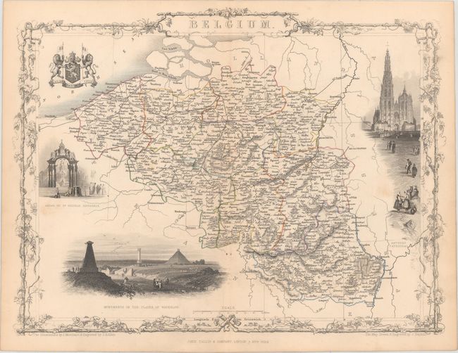
G. Belgium, (13.5 x 10.2"). Feature vignettes of the Antwerp Cathedral, Monuments on the Plains of Waterloo, Altar of St. Gudule, Brussels, and the royal coat of arms flanked by two ferocious lions.
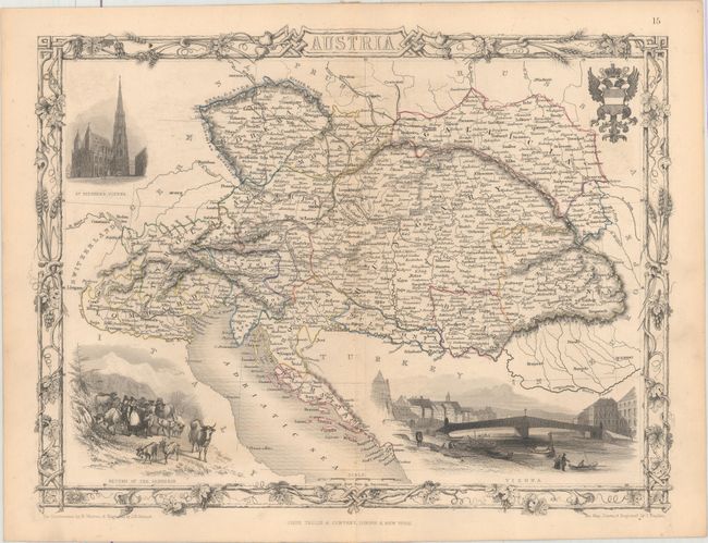
H. Austria, (13.1 x 10.0"). The map is centered on Vienna and extends to Northern Italy in the west and Transylvania in the east. Embellished with several finely engraved vignettes: St. Stephens, Vienna; Return of the Sennerin, Vienna, and a fancy coat-of-arms.
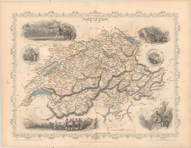
I. Switzerland, (12.8 x 9.8"). Surrounded by vignettes including William Tell Shooting at the Apple, Tyrolese, Bern and Chamois Hunters.
References:
Condition: B+
Original outline color with light toning and occasional soiling and/or staining.