Catalog Archive
Auction 157, Lot 435

"[Lot of 2] Carta del Oceano Atlantico Septentrional, con las Derrotas que Siguio Dn. Cristobal Colon... [and] Carta de las Costas de Tierra Firme Desde el Rio Orinoco Hasta Yucatan y de las Islas Antillas y Lucayas...",

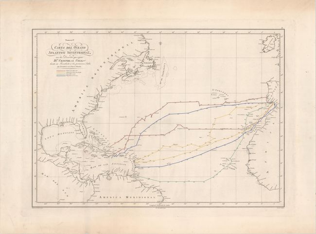
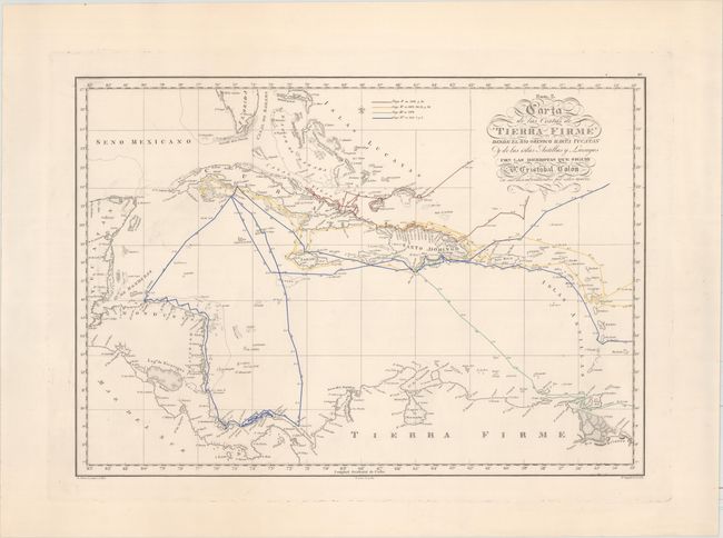
Subject: North Atlantic

Period: 1825 (dated)

Publication: Collection de los Viages y Descubrimientos...

Color: Hand Color

Size:
25.8 x 18.3 inches
65.5 x 46.5 cm
Download High Resolution Image
(or just click on image to launch the Zoom viewer)

These two uncommon Spanish maps depict Columbus' voyages of 1492, 1495, 1498 and 1502 to the New World. The first map covers the area from Spain and the west coast of Africa to the Caribbean and Gulf of Mexico. The second map is centered on Cuba and Hispaniola and extends south to Central America and northern South America. Each map shows Columbus' routes in four different colors to represent each voyage along with directional arrows and daily progress. Printed for Martin Fernandez de Navarrete's Collection de los Viages y Descubrimientos, Que Hicieron por Mar Los Españoles Desde Fines Del Siglo XV . . ." This work concerns itself with the Spanish Voyages of the 15th Century.

References:

Condition: A

Strong impressions on heavy wove paper with "Apres" watermark. Mostly clean and bright with faint printer's ink residue and a small abrasion in the first sheet with a tiny area drawn in facsimile (Cayman Islands).

Estimate: $400 - $500

Sold for: $250

Closed on 5/4/2016

Archived