Subject: Brazil
Period: 1747 (circa)
Publication: A Complete System of Geography…
Color: Black & White
Size:
16.8 x 13.8 inches
42.7 x 35.1 cm
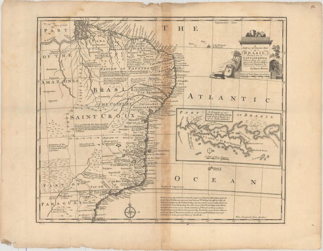
Copper engraved map with good detail along the coastal areas with scores of place names. The map covers the region between northern Paraguay and north to the mouth of the Amazon. A large inset of the Island of St. Katharine fills the blank ocean. In a lengthy note at bottom, Bowen states that he intentionally "omitted the imaginary Island of Ascension, upon the authority of Dr. Halley." The map includes several other notes, including an area said to "abound with Gold and Silver."
References: McCorkle (18th c. Geography Books) #17-22 (Vol II); Shirley (BL Atlases) T.BOW-2a #52.
Condition: B
Moderate toning along the centerfold with one short separation near the middle of the map. There is a faint damp stain in the upper left portion of the map image and some minor edge chips and tears confined to the blank margins.