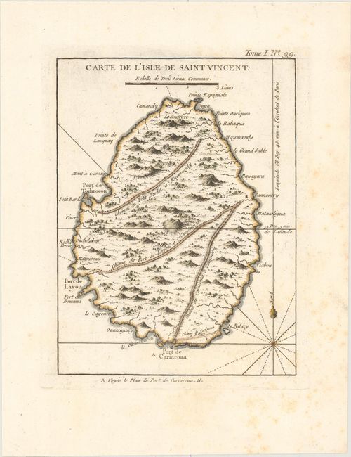
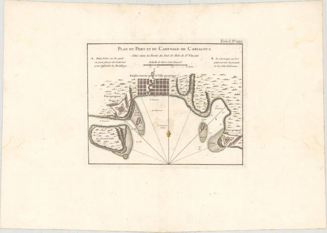
Subject: St. Vincent
Period: 1764 (circa)
Publication: Petit Atlas Maritime
Color: Hand Color
This pair of maps focuses on the island of St. Vincent, the largest island in the country of St. Vincent and the Grenadines. The first map features the entire island in exquisite topographical detail with place names along the coasts and roads inland. The second is an attractive bird's-eye plan showing the town of Calliaqua (Cariacoua) at the southern end of St. Vincent. Two "proposed forts" are depicted, as well as soundings, shoals, and a location suitable for anchoring both small and large vessels. The tiny island just south of Young Island, here called Le Grand Islet, later became the location for Fort Duvernette.
A. Carte de l'Isle de Saint Vincent, (6.4 x 8.5"). Condition: A crisp impression on a watermarked sheet with some light scattered foxing, most of which is in the blank margins.
B. Plan du Port et du Carenage de Cariacoua Situe dans la Partie du Sud de l'Isle de St. Vincent, (8.6 x 6.8"). Condition: A nice impression with wide margins and small minor stains around the centerfold. There are light damp stains in the blank margins, well away from image.
References: Sellers & Van Ee #2078 & #2083; Tooley (MCC-81) #2 & #4.
Condition: B+
See description above.