Catalog Archive
Auction 157, Lot 373

"Map of the European Settlements in the West Indies", Kitchin, Thomas

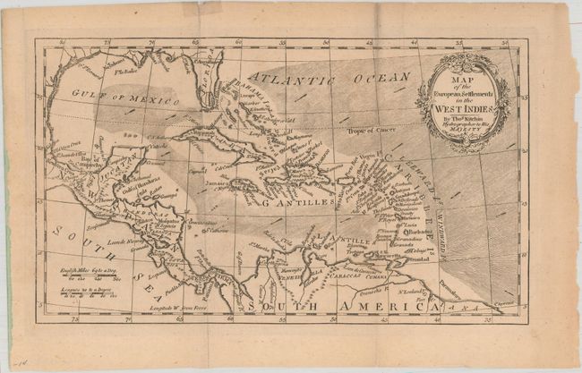
Subject: Gulf of Mexico & Caribbean

Period: 1776 (circa)

Publication:

Color: Black & White

Size:
10.6 x 6.2 inches
26.9 x 15.7 cm
Download High Resolution Image
(or just click on image to launch the Zoom viewer)

This nicely detailed map of the West Indies extends to cover parts of North America, Central America, and the northern coast of South America. Florida's southern tip is still coming into form with two large islands off the mainland. The map is filled with coastal place names and shows important rivers and mountains. Adorned by a decorative title cartouche and two distance scales.

References:

Condition: B+

Issued folding with a few short fold separations including one that extends 2" into the image that is closed on verso with archival tape. Minor extraneous creasing adjacent to the folds and light toning.

Estimate: $100 - $130

Sold for: $35

Closed on 5/4/2016

Archived