Catalog Archive
Auction 157, Lot 369

"Plan of the Road and Harbour of Chagre with the Town and Castle [on sheet with] A Draught of the Bahias del Almirante Named by the Buccaniers Bocatoro", Sayer & Bennett
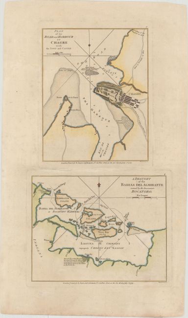
Subject: Panama

Period: 1779 (dated)

Publication: A New and Accurate Chart of the West-India Islands and Coast...

Color: Hand Color

Size:
8.8 x 16.3 inches
22.4 x 41.4 cm
Download High Resolution Image
(or just click on image to launch the Zoom viewer)

This sheet includes maps of two important ports along the Atlantic coast of Panama. The upper map on this sheet depicts a bird's-eye plan of the town and castle of Chagres, located at the mouth of the Chagres River. Details include soundings, shoals, rocks and roads. The lower map shows Almirante Bay, Laguna de Chiriqui, and the Bocas del Toro Archipelago in northwestern Panama. Engraved by Wigell and Creed.

References: Kapp (MCC-73) #85; Shirley (BL Atlases) M.SAY-4a #7-8.

Condition: A

Watermarked paper with wide margins and minor soiling.

Estimate: $275 - $350

Sold for: $200

Closed on 5/4/2016

Archived