Subject: Western United States & Mexico
Period: 1828 (dated)
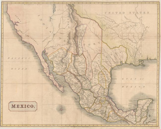
Publication: Mexico in 1827…
Color: Hand Color
Size:
26.5 x 21.1 inches
67.3 x 53.6 cm
This large, detailed map was published in Henry George Ward’s Mexico in 1827, and covers the region stretching from California to the Yucatan peninsula. It shows the political divisions of Mexico, which include Texas, New Mexico and New California. A large section of the map is simply labeled "Indian Territory." Includes fine detail of settlements, mines, topography and the river systems. In the west, California is almost completely void of detail with two rivers running from the Great Basin to the Pacific Ocean. Published by Henry Colburn in London.
References: Streeter #1104.
Condition: B
Issued folding, now pressed, with light offsetting. There are archival repairs to a few small fold separations and to three tears that enter 2-5" into blank areas of map at bottom and left. Narrow margins; trimmed to neatline at left.