Subject: Washington
Period: 1884 (dated)
Publication: HR Ex. Doc. 1, 48th Congress, 2nd Session
Color: Printed Color
Size:
28.8 x 21.8 inches
73.2 x 55.4 cm
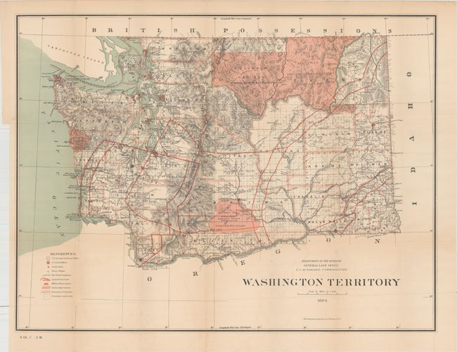
This colorful and graphic county map of the territory provides great detail throughout. It locates land surveys, Indian Reservations, military reservations, county boundaries, land grant limits and numerous railroad lines. Topography and watershed are well developed and railroad land grants are clearly shown with 40 and 50 miles limits indicated through color overprinting. Red patterns indicate the Indian Reservations and the applicable treaties are referenced. Several areas remain to be surveyed. Washington was admitted to the Union in 1889.
References:
Condition: B+
Issued folding with light toning, faint color offsetting, and a few tiny splits at fold intersections.