Subject: Salt Lake City, Utah
Period: 1860 (circa)
Publication: Weekly Dispatch Atlas
Color: Hand Color
Size:
12 x 17.3 inches
30.5 x 43.9 cm
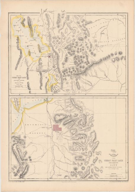
This sheet contains two maps. The upper map covers the region from the Great Salt Lake and Lake Utah east to Vernal and the Ashley Creek area (unnamed) and Fort Bridger in the north. It shows Salt Lake City in a block plan. Also locates Ogden, but no sign of Logan. Fort Utah is on the eastern shore of Lake Utah. The lower map is centered on Salt Lake City and features much more detail. The city plan clearly shows its rectangular grid layout and wide streets. The Welsh Settlement is shown to the southwest on the other side of the Jordan River. Both maps delineate the mountains in hachure and good detail of watershed. Lithographed by Day & Son. Drawn and engraved by Edward Weller of Bloomsbury. A scarce issue, more so due to the yellow, embossed stamp on the upper left noting this map was published as a supplement to the Sunday Weekly Dispatch of July 11th, 1858.
References:
Condition: A
Original color with a vertical crease that has been pressed flat.