Subject: Texas
Period: 1873 (dated)
Publication:
Color: Hand Color
Size:
27.5 x 17 inches
69.9 x 43.2 cm
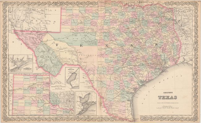
This later edition Colton is an interesting double page map that uses the title of the earlier (1855-59) single-sheet map but presents the same information as the double page "New Map of the State of Texas Compiled from J. de Cordova's large Map," also published in the 1850's. The map presents extensive detail throughout the settled part of the state. The western third is comprised of the large unsettled areas of Presidio, El Paso, Pecos, Bexar Territory and Young Territory. With excellent detail of railroads, forts, post offices, roads, springs, watershed and topography. County development is current to 1873. Large inset: "Plan of the Northern Part or Panhandle of Texas" plus three smaller insets Plan of Galveston Bay from the U.S. Coast Survey; Plan of Matagorday Bay; and Plan of Sabine Lake. This handsome sheet has fancy titling and a decorative scroll border.
References:
Condition: B+
Light toning along sheet edges and soiling along the centerfold at bottom.