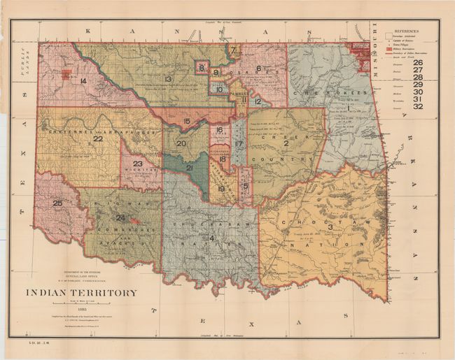
Subject: Oklahoma
Period: 1885 (published)
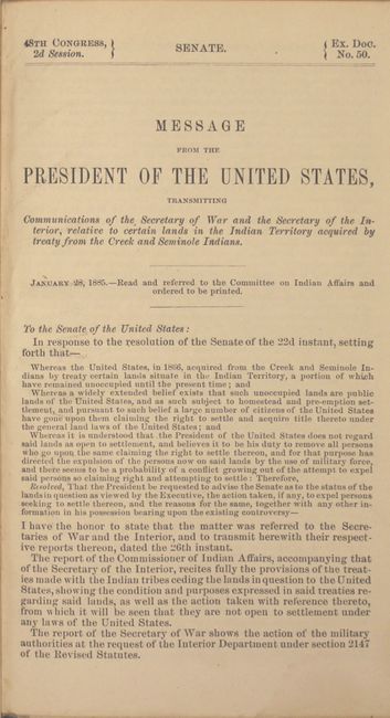
Publication: Senate Ex. Doc 50, 48th Cong., 2nd Sess.
Color: Printed Color
Size:
32.2 x 24.1 inches
81.8 x 61.2 cm
A most interesting and detailed map reflecting the status of lands allocated to various tribes (color-coded). Indian removals from 'home lands' began as early as 1817, and in the years following many of the principal Eastern Indian tribes were relocated to the region with the Five Civilized Tribes having formed the nucleus of an organized government. By 1885, however, representatives of some fifty tribes had settled on lands once promised to the original five. This map reflects many of these allocations and provides some data on the pertinent treaties involved. It does not include the panhandle, which by this time are Public Lands. Drawn by G. P. Strum. The map is accompanied by the original 71-page report. 8vo, rebound in blue simulated cloth over floral paper boards and endpapers.
References:
Condition: A
Attractive color with faint offsetting and a few tiny splits at fold intersections. There is a binding trim at lower left, but still ample room for framing. Report text is very good and the modern binding is pristine.