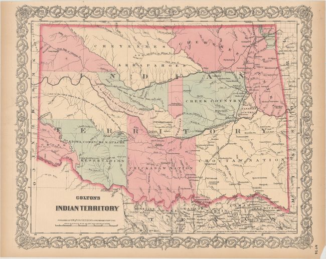
Subject: Oklahoma
Period: 1872 (dated)
Publication:
Color: Hand Color
Size:
15.7 x 12.9 inches
39.9 x 32.8 cm
This detailed map reflects the status of lands allocated to various tribes. In 1817 the U.S. government began to relocate the principal eastern Indian tribes from their traditional home lands to Indian Territory where the Five Civilized Tribes formed the nucleus of an organized government. By the 1870s there were more that twenty-five tribes settled on lands once promised to the original five. This map does not include the panhandle, which at this time are in Public Lands. The attractive map is surrounded by Colton's signature strapwork border. The verso contains the left side of a double-page map of Nebraska.
References:
Condition: B+
Light toning primarily along sheet edges with a small chip at bottom right.