Subject: New York
Period: 1851 (published)
Publication:
Color: Black & White
Size:
72 x 8 inches
182.9 x 20.3 cm
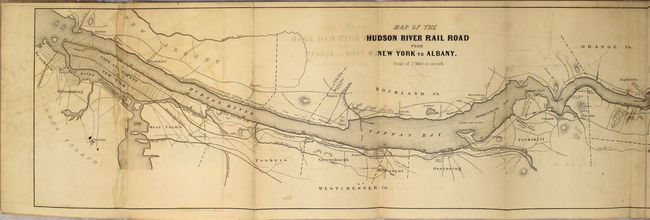
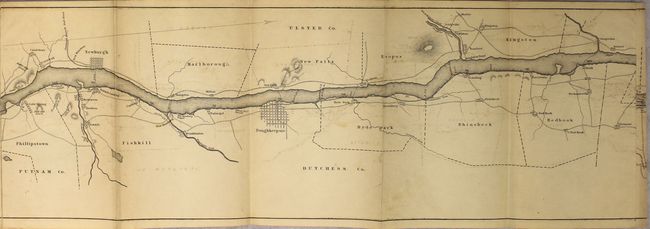
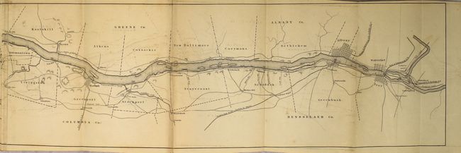
This rare map is contained in the original booklet "Hudson River, and the Hudson River Rail-Road with a Complete Map and Wood Cut Views of the Principal Objects of Interest upon the Line," 50pp. (6 x 9"). This is an excellent mid-19th century guide to the Hudson Valley and its recently built 144 mile long railway. The long map covers the entire length of the line from Brooklyn to Troy showing local topographical features, roads, towns, county boundaries and river landings. Points of interest are noted such as Sing-Sing prison, ferries, print works, mills and more. The booklet describes the railroad plus fifty cities, towns, and places of interest. Advertisements on the back covers. A rare issue in its first edition with the single sheet map -- a later example is known to exist with the map printed on three separate sheets.
References:
Condition: B
Light toning, moderate offsetting, and a bit of staining where the map was glued to the inside front cover. Text is very good with pleasant light toning. Paper wrappers have been reinforced with archival tape along the spine.