Subject: Boston, Massachusetts
Period: 1770 (circa)
Publication:
Color: Hand Color
Size:
8.2 x 6.3 inches
20.8 x 16 cm
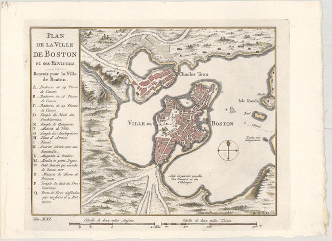
Attractive early plan of Boston and the harbor including Charles Town and Isle Ronde. It shows the street plan of the town and wharves, and locates gun batteries, powder magazines, Presbyterian churches, a prison, a town hall, a windmill, and a beacon. It indicates an offshore anchorage and the entrance channel and also depicts shoreline topography with the roads running down to the harbor. Large key at left lists sixteen important sites. Engraved at bottom neatline is Tom. XXI. This is very similar to the 1764 Bellin issue from the Petit Atlas Maritime, Tome I, No. 31, but the title and index are placed on the left.
References:
Condition: A
Nice impression and color with some minor paper weakness in the far left blank margin.