Subject: Washington, D.C.
Period: 1800 (circa)
Publication: Jungern, Reisen Durch die Staaten von Nordamerika
Color: Black & White
Size:
8.4 x 6.7 inches
21.3 x 17 cm
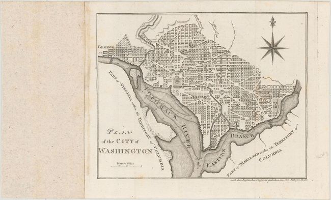
This is a reduced and simplified version of Ellicott's plan of 1792. Washington is bordered by the Potomack (Potomac) River and the Eastern Branch, now the Anacostia River. Georgetown, at the left and northwest of Rock Creek, is separately labeled. Reedy Branch and Tiber Creek are shown to the north outside of the street pattern. A few major buildings including the Capitol and Presidents House are labeled; others are merely outlined. The proposed landscape design for the Mall is shown with some detail. Near the upper right is an eight-pointed compass indicator surmounted by a fleur de lis. Engraved by Carl Jattnig.
This is a rare German plan, apparently found only in the "Magazin" edition of Weld's Travels.... This map does not appear in Phillips' Maps and Views of Washington and District of Columbia.
References: Mickwitz & Miekkavaara #716-4; Howes #W-235, cf. Phillips (DC) PW #37.
Condition: A
Issued folding with some faint stains primarily in the blank margins.