Subject: Washington, D.C.
Period: 1793 (dated)
Publication: Universal Magazine
Color: Black & White
Size:
13.5 x 10.8 inches
34.3 x 27.4 cm
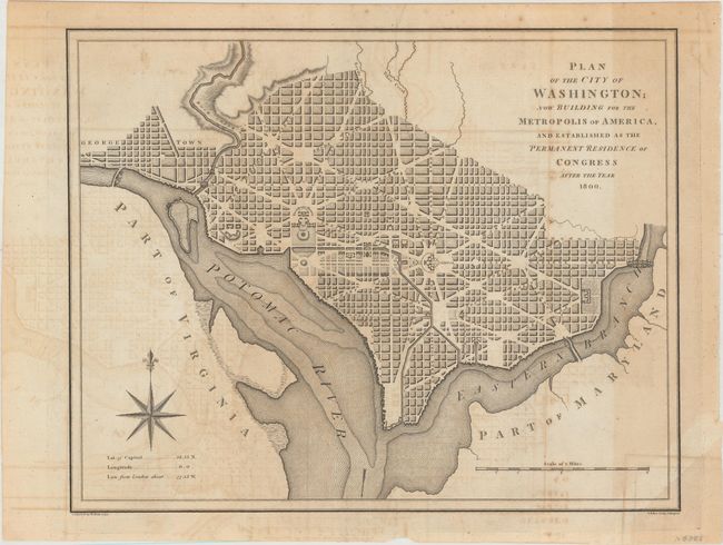
Very early plan of the new capital city based on the 'Philadelphia' version of Andrew Ellicott's manuscript plan of 1792. This is one of the earliest printed maps of Washington, barely a year after Hill's plan was issued, and only the third plan of DC to be published in England. The map shows a few major buildings including the Capitol and the Presidents House; others are simply outlined. The proposed landscape design for the Mall is shown with considerable detail. Outline contours of docks and slips are shown along the rivers. This version was circulated in London in the hope of stimulating overseas investment. Engraved by Baker and published by W. Bent.
References: Baynton-Williams, “Plans of Washington, D.C.”, MapForum.com, Issue 12, map 8; Jolly #UNIV-228; Phillips (M) p. 1004; Verner & Stuart-Stubbs, 8.
Condition: B
A crisp impression on watermarked paper, issued folding, with offsetting, light toning, and a mis-fold at bottom right. Remnants of hinge tape on verso.