Catalog Archive
Auction 157, Lot 240

"[Lot of 5] Map of Washington Oregon and Idaho [and] Map of California and Nevada [and] Map of Nebraska, Dakota. Montana, and Wyoming [and] Map of Colorado, Utah, New Mexico, and Arizona [and] Map of Texas", Williams, J. David

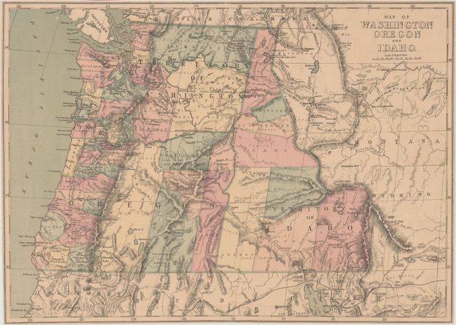
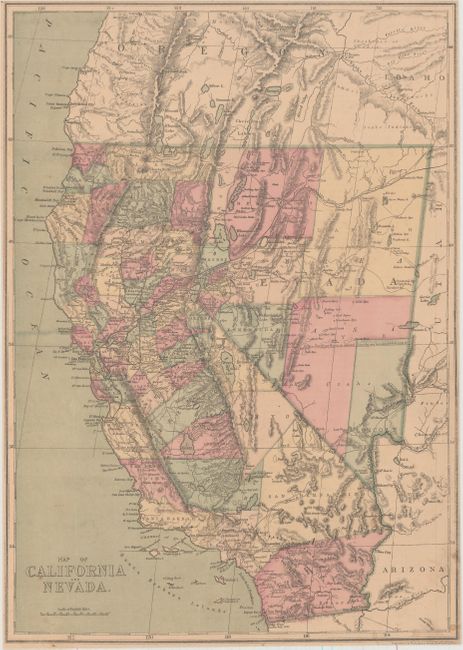
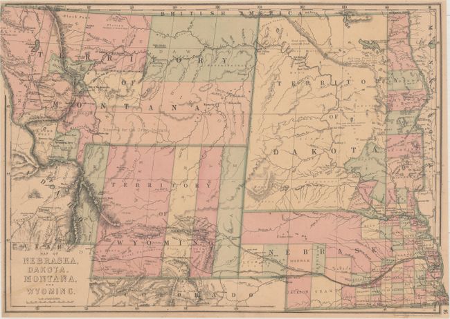
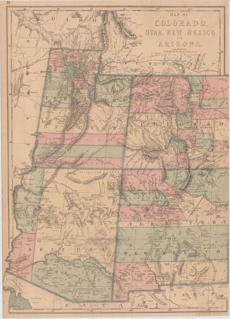
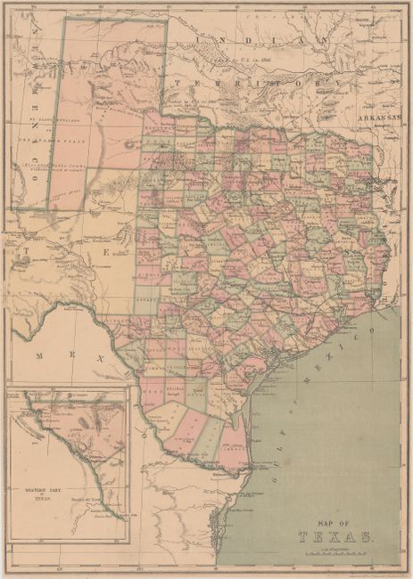
Subject: Western United States

Period: 1874 (circa)

Publication: People's Pictorial Atlas

Color: Hand Color

Size:
17 x 12.2 inches
43.2 x 31 cm
Download High Resolution Image
(or just click on image to launch the Zoom viewer)

This lot of five detailed maps of the Western United States was issued in Williams' People's Pictorial Atlas. These maps use longitudinal projection lines, which increase in width the further south one goes, to more accurately reflect the curvature of the earth and distance between degrees of longitude. The maps are hand colored by county and show the oversized counties that the western states and territories had at this time period. Filled with notations, the maps also locate towns and settlements, Indian tribes, watersheds and topography. Blank versos. A great set of maps for study of the West after the completion of the Trans-Continental Railroad.

References:

Condition: B+

Pleasant light toning, minor soiling, and generally narrow margins. The map of Washington and Oregon is trimmed close to the neatline all around.

Estimate: $275 - $350

Sold for: $1,300

Closed on 5/4/2016

Archived