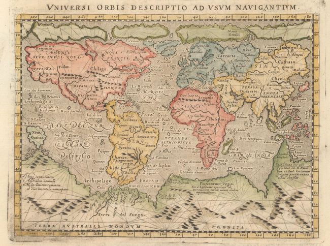
Subject: World
Period: 1713 (published)
Publication: Universus Terrarum Orbis Scriptorum
Color: Hand Color
Size:
6.9 x 5 inches
17.5 x 12.7 cm
This small mariner's map is based on one of the most important world maps of the 16th century: Gerard Mercator's multi-sheet map of 1569. The map reflects the belief in wide Arctic sea passages and depicts a huge southern continent, to which fanciful ranges of mountains have been added. A fine network of rhumb lines crisscross the map, and the oceans are stipple engraved in the Italian style. Girolama Porro originally engraved this map for Giovanni Magini's quarto edition of Ptolemy's Geographia in 1596. The map was very popular and subsequently appeared in Lasor a Varea's work more than a century after it was first engraved. On a full sheet of Latin text measuring 8.9 x 13.3".
References: cf. Shirley #196.
Condition: A
Watermarked paper with light printer's ink residue at lower left and marginal soiling.