Subject: Central United States
Period: 1870 (dated)
Publication:
Color: Hand Color
Size:
15 x 20.1 inches
38.1 x 51.1 cm
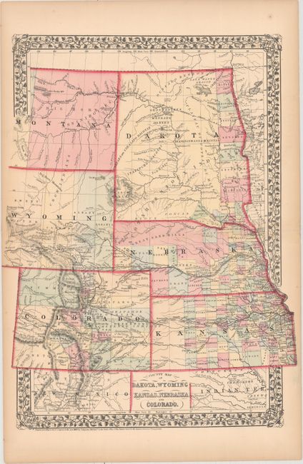
In 1870 Mitchell issued a new regional map of the northern plains. It replaced his previous series in a vertical format to show the whole of Dakota Territory and the eastern part of Montana. Dakota has a band of counties in the east with the balance of the territory firmly in the hands of various bands of Sioux Indians. Montana is likewise still completely the domain of the Indians with only Forts Union and Alexander located. The proposed route of the Northern Pacific Railroad runs across both territories. Wyoming is limited to 4 counties, and is still largely unexplored north of the Pony Express Route. Colorado shows the signs of its mining boom with the Gold Region shown south of Denver. Rapid development is evident in both Kansas and Nebraska and railways are completed through both states. The western boundary of Wyoming is at the edge of the map, as issued.
References: Blevins #196, #347.
Condition: B+
Original color with light toning primarily along sheet edges and several creases confined to the blank margins.