Subject: North Carolina & South Carolina
Period: 1796 (circa)
Publication: The American Universal Geography
Color: Black & White
Size:
9.1 x 7.4 inches
23.1 x 18.8 cm
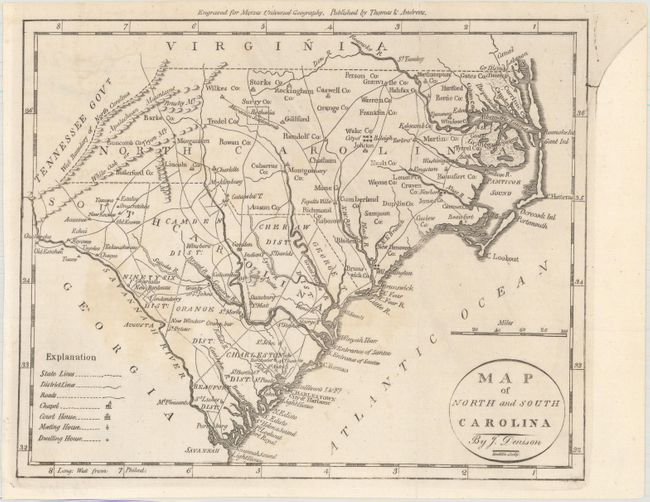
This small map of the Carolinas features a legend that identifies district lines, roads, chapels, courthouses, meeting houses, and dwellings. The counties and districts in each state are named but are only delineated in South Carolina. There is a Moravian settlement near Guilford, NC. The Tennessee Gov't borders North Carolina to the west. This attractive early American map was created by James Denison, engraved by Amos Doolittle, and carries the imprint of Thomas & Andrews above upper neatline.
References: McCorkle (18th C. Geography) #304-14; Wheat & Brun #585.
Condition: B+
Issued folding with a few faint stains and a short fold separation at top right that has been closed on verso with archival materials.