Subject: Mid-Atlantic United States
Period: 1862 (published)
Publication: Weekly Dispatch Atlas
Color: Hand Color
Size:
12.5 x 17.8 inches
31.8 x 45.2 cm
Very attractive set of Civil War Maps.
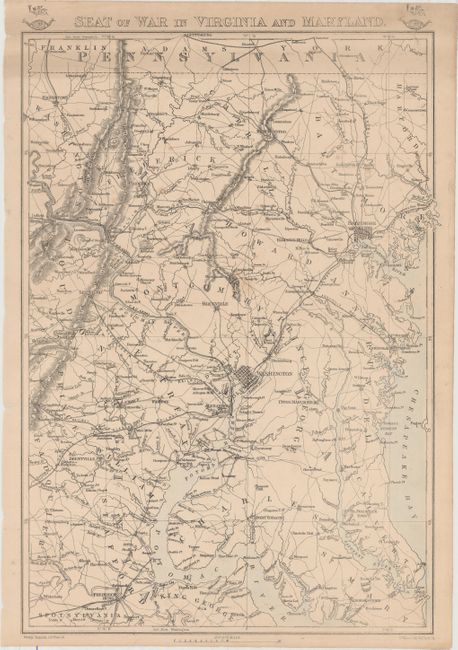
1) Seat of War in Virginia and Maryland shows the area around Washington, D.C., from Spotsylvania in the south, to the Pennsylvania state line. Baltimore, Washington and Annapolis are prominent, and other details include rail lines, roads, counties and topography. Water areas have attractive hand color.
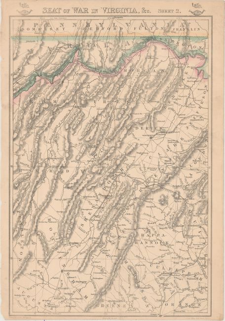
2) Seat of War in Virginia, &c. Sheet 2. covers the area in northern Virginia between the Maryland border to just south of Harrisonburg and Fairfax. It shows rail lines, roads, counties and topography. Some attractive hand coloring along the state boundaries.
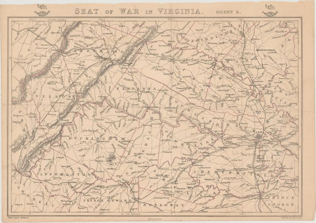
3) Seat of War in Virginia. Sheet 3. covers the vicinity of Richmond, Lynchburg and Staunton with counties, towns, roads, railroads, etc. Hand color delineates county boundaries.
References:
Condition: B+
Each sheet has original color, an extraneous fold and minor toning. The first sheet has light soiling at top and a couple of spots of foxing. The second sheet has a 1/2" tear at bottom.