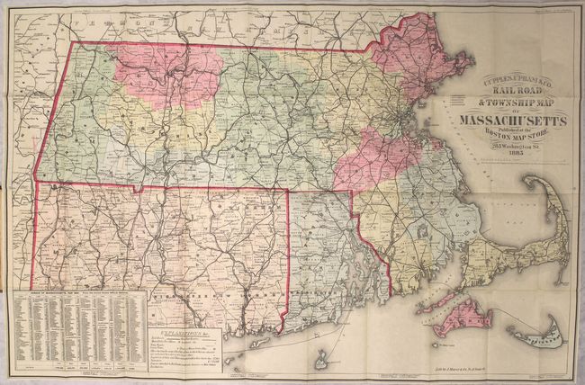
Subject: Massachusetts, Connecticut, Rhode Island
Period: 1885 (dated)
Publication:
Color: Hand Color
Size:
32 x 20.9 inches
81.3 x 53.1 cm
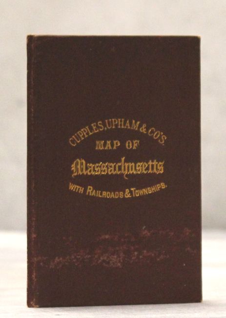
This uncommon map of Southern New England focuses on Massachusetts, along with additional detail of Connecticut and Rhode Island. Delineated by county, the map depicts railroads, post routes and ferry routes. Each township has an estimated monetary value associated with it - an unusual feature. Includes a table at bottom with state census data with a "foreign" population representing about a quarter of the total. Published at the Boston Map Store at 283 Washington St. Folds into maroon cloth-covered board with gilt title on front cover.
References:
Condition: A
Attractive example, issued folding, with a few minor spots. Front board has a light abrasion below the title.