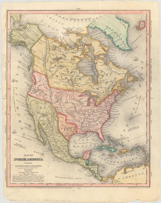
Subject: North America, Texas
Period: 1844 (dated)
Publication: Olney's School Geography
Color: Hand Color
Size:
8.6 x 10.5 inches
21.8 x 26.7 cm
This great school geography map includes a large Independent Republic of Texas with a long stovepipe panhandle. Locates Santa Fe, San Antonio de Bexar, and Houston. Above Texas is the Great American Desert. The United States extends to the Pacific with Astoria, Willamette, and Ft. Wallah-Wallah named. The Northwest extends well into Canada geographically showing the Fifty-four Forty or Fight dispute with Britain. Mexico controls California and the Southwest while Alaska is Russian Possessions with the Aleutian Peninsula labeled Alaska. Cook's Inlet is well shown. States are not shown in the U.S. or Mexico, but the population of each country is on the map. A population of 500,000 is given for Texas. Numerous Indian tribes and major towns are named. There is good detail of major rivers, and a vague idea of the "Rocky or Oregon" mountains. The Great Basin is here called the Sandy Plains.
References:
Condition: A
There are two faint spots in the image and several tiny chips along the sheet edges far from map image.