Catalog Archive
Auction 156, Lot 87

"Amerique Septentrionale", Robert de Vaugondy, Gilles

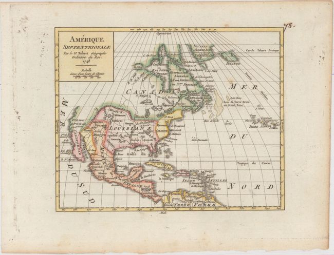
Subject: North America

Period: 1748 (dated)

Publication: Atlas Portatif Universel et Militaire

Color: Hand Color

Size:
7.7 x 6.2 inches
19.6 x 15.7 cm
Download High Resolution Image
(or just click on image to launch the Zoom viewer)

Nice small map of the continent depicting the political boundaries. The British colonies are confined to the eastern seaboard and there is a very large Louisiane. The Ohio River is labeled R. des Ouabaches. The entire Northwest coast, above the peninsula of California, is blank. There is an open-ended bay in Hudson Bay leaving open the possibility of the Northwest Passage. Simple block title cartouche.

References: Pedley #446.

Condition: A

A crisp impression with attractive color and one small spot of foxing in the North Atlantic.

Estimate: $120 - $150

Sold for: $90

Closed on 2/17/2016

Archived