Subject: Eastern Africa
Period: 1774-1821 (dated)
Publication:
Color: Hand Color
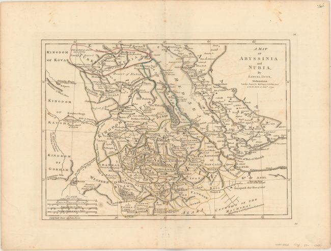
A. A Map of Abyssinia and Nubia, by Samuel Dunn, dated 1774 (15.8 x 11.4"). This map gives extensive detail of the region along the Red Sea, including present-day Egypt, Sudan, Eritrea, Djibouti, Ethiopia, and a small portion of Saudi Arabia. Political divisions, towns, roads, and topography are depicted along with several short notations. Three rivers well north of the equator are shown as the source of the Nile River, including Lake Dambea, Lake Kaouir, and The Fresh Water Sea or Nubian Marsh of Ptolemy. Condition: Original outline color on watermarked paper with light offsetting, a few small spots of foxing, and a centerfold separation that just enters the map border at bottom. (B+)
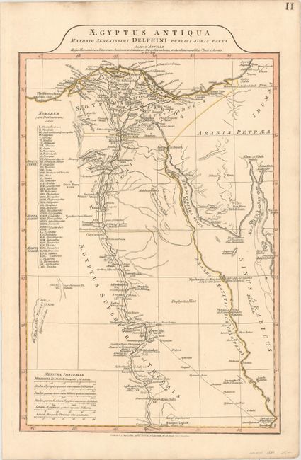
B. Aegyptus Antiqua Mandato Serenissimi Delphini Publici Juris Facta Auctor d'Anville..., by Richard Holmes Laurie, dated 1821 (12.3 x 19.1"). This very finely engraved map shows the region of Ancient Egypt divided into four districts: Aegyptus Inferior, Heptanomis, Aegyptus Superior or Thebaise, and Arabia Petraea that includes Gaza. A table gives the Nomorum, or administrative districts of Upper and Lower Egypt, which are depicted by Roman numerals on the map. The details include the pyramids, the Natron valley, rivers, cities, roads, oases and much else of interest. Both ancient and contemporary place names are included with the ancient names underlined. Condition: Original color with marginal soiling. (A)
References:
Condition:
See description above.