Catalog Archive
Auction 156, Lot 714

"A Map of the Continent of the East-Indies &c. Containing the Territories, Settlements, and Factories of the Europeans. Explaining What Belongs to England, France, Holland, Denmark, Portugal &c. ", Moll, Herman

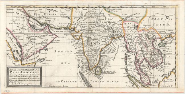
Subject: Southern Asia

Period: 1729 (published)

Publication: Atlas Minor: Or, A Set of Sixty-Two New and Correct Maps of All the Parts of the World

Color: Hand Color

Size:
16.4 x 8 inches
41.7 x 20.3 cm
Download High Resolution Image
(or just click on image to launch the Zoom viewer)

This map covers the region from Arabia east to India, China and part of Borneo. Features good place name details throughout and particularly detailed along the coast of India and Ceylon. South of the Kingdom of Lassa is the fictitious Chamay Lake, and the straits of Sincapora are located to the north of Sumatra. Decorated by Moll's simple block-style cartouche.

References: Shirley (BL Atlases) T.MOLL-9a #62.

Condition: A

Original outline color on paper with a flower watermark. There are a few tiny fold separations confined to the blank margins and closed on verso with archival material. Issued folding and now pressed flat with minor printer's ink residue.

Estimate: $375 - $450

Sold for: $325

Closed on 2/17/2016

Archived