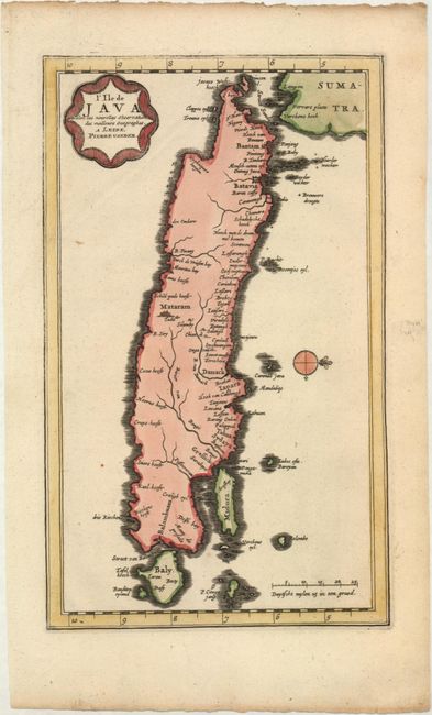
Subject: Java
Period: 1719 (circa)
Publication:
Color: Hand Color
Size:
6.3 x 10.5 inches
16 x 26.7 cm
This rare map of Java is oriented with west to the top of the sheet by a small compass rose. There are a number of place names along the northern coastline and virtually none along the mysterious southern coast. Three cities are located: Bantam, a major trading port on the Sunda Strait; Batavia, the Dutch (VOC) colonial center; and Mataram, the major Muslim trade center in the interior. For much of the seventeenth century Mataram, Bantam and the VOC vied for control of Java. A small part of Sumatra appears at the top of the map and Bali is depicted at the bottom. The title is enclosed in a unique cartouche design.
References:
Condition: A
A clean and bright example on watermarked paper with minor creasing at top left.