Catalog Archive
Auction 156, Lot 666
"Nouvelle Carte de l'Empire de la Chine, et les Pais Circonvoisins / Nieuwe Kaart van 't Keizerryk China, en de Aangrensende Landen", Tirion, Isaac
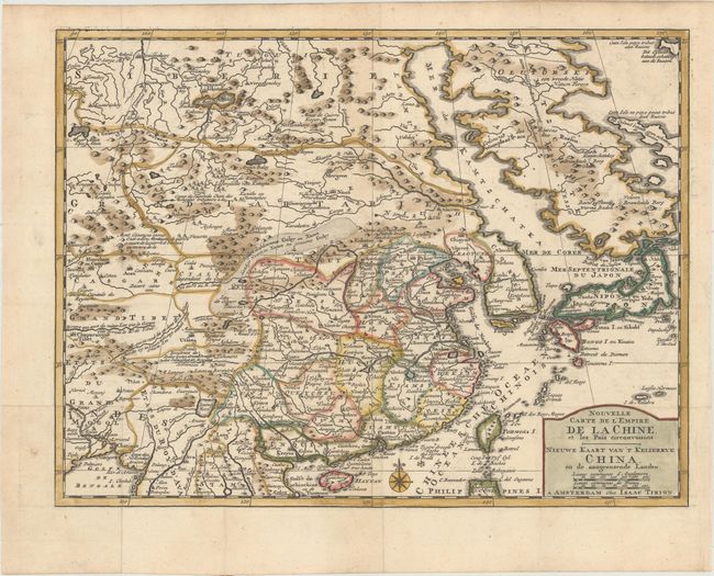
Subject: China, Korea & Japan
Period: 1769 (circa)
Publication: Nieuwe en Beknopte Hand Atlas
Color: Hand Color
Size:
13.1 x 10 inches
33.3 x 25.4 cm
Download High Resolution Image
(or just click on image to launch the Zoom viewer)
(or just click on image to launch the Zoom viewer)