Subject: Low Countries
Period: 1675 (dated)
Publication:
Color: Hand Color
Size:
22.1 x 18.4 inches
56.1 x 46.7 cm
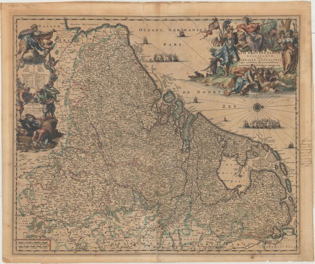
This detailed map shows the Netherlands, Belgium, Luxembourg, and portions of Germany and France. It is teeming with towns and cities, including Amsterdam, Rotterdam, Antwerp, Brussels, Luxembourg City, Cologne, and Dusseldorf, and there is nice topographical detail. Numerous ships fill the North Sea along with a compass rose capped with a fleur-de-lis that orients the north to the right. There are two elaborate decorative cartouches featuring allegorical figures: one at left that includes a key and one at right with the title.
References:
Condition: B
A strong impression with toning, scattered foxing, and a 4.5" fold separation at bottom that has been repaired on verso with archival material. Manuscript notations are confined to the right blank margin and the verso has paper tape along sheet edges.