Subject: Amsterdam, Netherlands
Period: 1730 (circa)
Publication: Atlas Maior...
Color: Hand Color
Size:
22.4 x 20.4 inches
56.9 x 51.8 cm
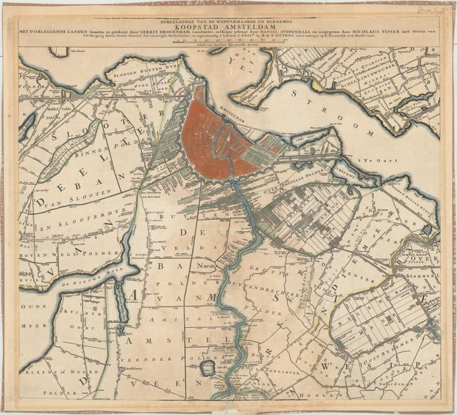
This is the central sheet of an uncommon three sheet map of Amsterdam and its surroundings. It is based on the work of surveyor Gerrit Droogenham, who collaborated with Visscher on a plan of Amsterdam in 1700. The fortified city is shown in detailed plan form along with excellent detail of the area's waterways and flood control systems.
References: Phillips (A) #4257-68 & 69 (v. 4).
Condition: B
A fine impression with a few short tears and chips along the centerfold with tiny portions of the map replaced in facsimile. There is a large light damp stain around the centerfold at bottom and light toning in the blank margins. A border has been added in manuscript, and the verso has paper tape along sheet edges.