Subject: Wales
Period: 1675 (circa)
Publication: Britannia
Color: Hand Color
Size:
16.4 x 13 inches
41.7 x 33 cm
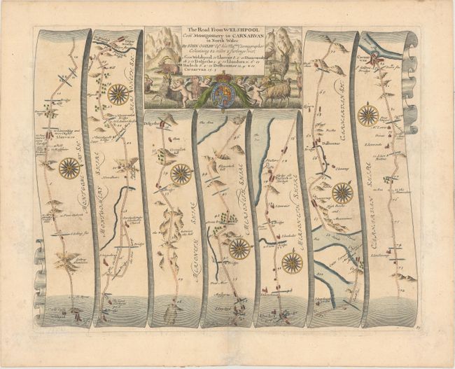
John Ogilby's 'Britannia' was published between 1675 and 1698. It is a landmark in the mapping of England and Wales. Its unique format constituted the first national road-atlas of any country in Western Europe. It was composed of maps of seventy-three major roads and cross-roads, presented in a continuous strip-form, on a uniform scale of one inch to a mile. Each beautiful map includes wonderful detail of the countryside with each strip containing a large compass rose to indicate changes in direction.
Attractive strip-style map covering the road from Welshpool to Carnarvan in seven strips totaling 82 miles. Each of the seven panels has a decorative compass rose to orient the traveler. The title cartouche is flanked by putti, mountain goats, and the royal coat of arms.
References: Shirley (BL Atlases) T.OGIL-4a #87.
Condition: B+
A nice impression on watermarked paper with light toning and soiling, one small hole caused by a rust stain, and some archival repairs to several short centerfold separations.