Catalog Archive
Auction 156, Lot 441
"Nouvelle Carte de l'Angleterre dans l'Aqu'elle l'on Observe les Comtez, les Archeves, chez les Eveschez, les Universitez, les Villes, et les Bourgs, qui Deputent au Parlement; avec l'Etat Present des Comtez de ce Royaume", Chatelain, Henry Abraham
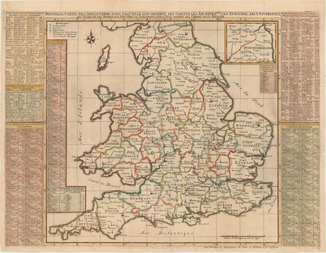
Subject: England & Wales
Period: 1710 (circa)
Publication: Atlas Historique…
Color: Hand Color
Size:
24.9 x 18.6 inches
63.2 x 47.2 cm
Download High Resolution Image
(or just click on image to launch the Zoom viewer)
(or just click on image to launch the Zoom viewer)