Subject: Brazil
Period: 1680 (circa)
Publication:
Color: Hand Color
Size:
23.2 x 19.6 inches
58.9 x 49.8 cm
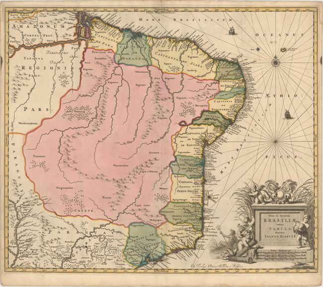
This scarce map is Johannes Blaeu's third map of Brazil. It includes the capitanias along the coast and is a significant improvement over Blaeu's previous maps of Brazil. The handsome cartouche is surrounded by cherubs and a river god. This map, designed by Joannes de Broen and engraved by Abraham Wolfgang, was completed shortly before the great fire that destroyed the printing house, and therefore was included in only one edition of Blaeu's atlases. In 1694 Pieter Schenk acquired a number of Blaeu's copperplates, including this one. This map does not have Schenk's imprint, but the engraver's imprint has been erased.
References: Van der Krogt (Vol. II) #9850:2C.
Condition: B+
Full original color with one tiny crack caused by the oxidation of the green pigment that has been closed on verso with archival material. Minor soiling and two vertical creases, which were likely created to include the map in a composite atlas.