Subject: Caribbean
Period: 1851-60 (circa)
Publication:
Color:
Size:
13 x 10.1 inches
33 x 25.7 cm
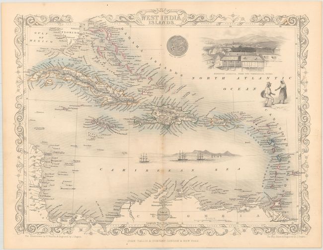
The maps from The Illustrated Atlas were first published in serial form to a target audience that led insular lives due to the expense and hardship of travel. All that changed as the progress of the nineteenth century brought swift and dramatic changes in public awareness of far away places. Tallis' maps no doubt played an important role in this dramatic awakening. These maps not only provided up-to-date geographical knowledge, but also used vignette views within the map's design to show the native people and their occupations, cities and points of interest. The maps hark back to a cartographic tradition from the Dutch mapmakers of the seventeenth century with finely engraved decorative borders. The maps were drawn and engraved by John Rapkin with views drawn and engraved by a number of prominent artists. The maps were issued as a complete volume from 1851 until about 1865. Some of the maps were also published in other history books published by Tallis including British Colonies and, without the vignettes, in geographical dictionaries and encyclopedias until about 1880.
A. West India Islands, from Illustrated Atlas and Modern History of the World, circa 1851, hand color. A very handsome chart of the Caribbean with fine detail and pleasant coloring. Chart extends from the Bahamas through the Caribbean Islands and Trinidad to Columbia. The vignettes are beautifully engraved by J. Rogers after the art of H. Warren. The predominate vignette is "Kingston, Jamaica from the Commercial Rooms," plus a view of clipper ships anchored offshore, a small engraving of a native couple, and a coin. The vignettes and borders are uncolored, as issued. Condition: There are a few faint spots along the centerfold, else fine.
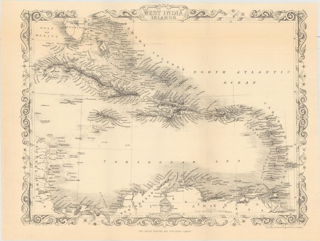
B. West India Islands, circa 1860, black & white. This is a later edition of the map above without the vignettes. Condition: Issued folding.
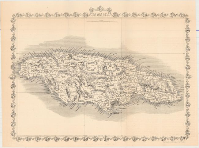
C. Jamaica, circa 1860, black & white. This later edition chart of the island without vignettes includes good detail with the names of many villages and coastal features. The island is sectioned into about 20 Administrative Divisions. The divisions of St. Dorothy, St. John, St. Thomas, Port Royal, and St. Davids have been absorbed by the 14 divisions we see today. Condition: Issued folding.
References:
Condition: A
Overall clean and bright examples. See description above for additional details.