Subject: United States & Mexico, Central America
Period: 1850 (dated)
Publication:
Color: Hand Color
Size:
25.1 x 22.9 inches
63.8 x 58.2 cm
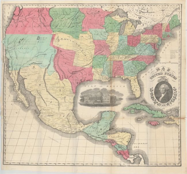
A scarce large format map of the United States with striking insets of President Washington and a view of the Capitol of Washington. The projection oddly distorts and for-shortens the western portion of the U.S. It depicts the state of Texas in its elongated stovepipe configuration, which is quite unusual for a map dated 1850. The very interesting territorial configurations include an outdated California that includes present-day Utah, Nevada, Arizona and New Mexico, a large Oregon Territory occupying the entire Northwest extending to the Continental Divide, and a huge Missouri Territory that extends east to an oversized Minnesota Territory at the Missouri River. The very large Indian Territory sits between Texas, Missouri, and Missouri Territory. The map extends to include most of Central America and the western part of the West Indies. Lacks covers.
References:
Condition: B+
Issued folding with a 2.5" edge tear at left that has been closed with archival tape on both verso and recto. Light toning along one fold and a few extraneous creases.