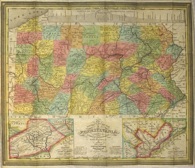
Subject: Pennsylvania
Period: 1838 (dated)
Publication:
Color: Hand Color
Size:
15.1 x 12.6 inches
38.4 x 32 cm
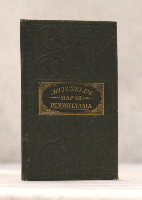
This attractive example features insets of the Lehigh and Schuylkill Coal Regions and the Vicinity of Philadelphia with a large profile of the Pennsylvania Canal across the top. The map has 1831 copyright imprint, but this edition is updated to 1838 as noted below the title. The map shows the addition of Potter County (1835) and Monroe County (1836) but not Clarion, which was organized in 1839. The map is finely engraved with detail throughout locating many roads, towns, and railroads with good topographical information. Printed on fine banknote paper and folds into original, gilt-stamped green cloth covers measuring 3" x 5". Original paper label inside the front cover gives population by county from the 1830 census.
References:
Condition: A
Near fine with a few faint spots and one tiny split at a fold intersection. The covers are in excellent condition.