Subject: World
Period: 1841-42 (circa)
Publication:
Color: Hand Color
The beginning of the nineteenth century saw a period of rapid market growth and innovation in the map publishing world. Increased literacy and public interest in new frontiers and colonies overwhelmed the market because it was oriented toward the small, affluent market of the previous century. With the intent to fill this void, The Society for the Diffusion of Useful Knowledge (SDUK) was founded in 1828 in London, by Lord Brougham and a group of men dedicated to the education of the aspiring working class and the Utilitarian ideal of 'Knowledge is Power.' The society produced an array of education materials, but the series of maps was one of their most successful ventures. A number of engravers and printers were used to produce the maps, which eventually exceed 200 sheets, and continued to be published after the Society as a whole ceased to function.
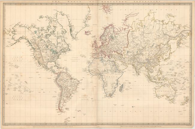
A. The World on Mercator's Projection, dated 1841 (23.8 x 15.4"). This delicately detailed map presents a considerable amount of information. The United States is shown excluding the Southwest and Texas. Texas was an independent country from 1836-1845, but it is shown here as part of Mexico. The northern border of the United States and Canada shows the disputed border for Oregon Territory coming down to about the 45th parallel at the Columbia River, which reflects British claims in that region. This was finally solved in 1846 with the border at the 49th parallel. The Arctic region shows the extent of contemporary knowledge, noting nothing besides Packed Ice north of the Bering Strait. Africa is shown with much of its interior left unmapped - that region was not mapped thoroughly until the latter part of the 19th century. An attractive and informative map surrounded with a keyboard style border. Engraved by J. & C. Walker.
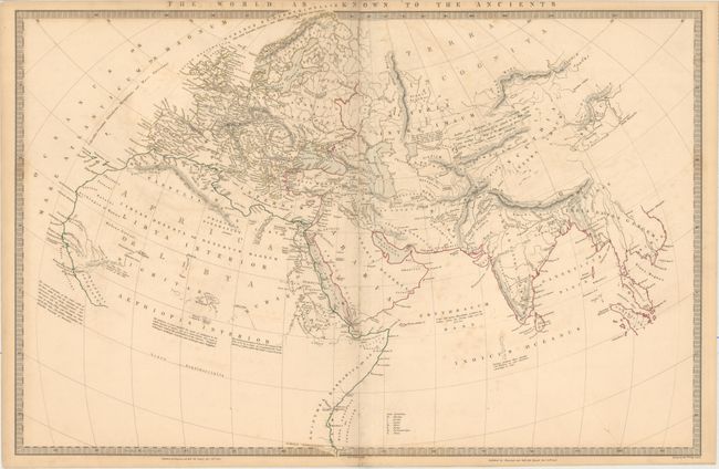
B. The World as Known to the Ancients, dated 1842 (23.7 x 15.7"). Attractive map showing the world that was known in classical times. The mapmakers used Rennell's Geography of Herodotus, as well as information from Hanno, Pliny and Ptolemy. As is the case with most maps from this series, there are numerous interesting notations that add information to the map and are particularly illuminating for a person wishing to better understand ancient geography. Drawn by Rev. Philip Smith, engraved by J. & C. Walker, and published by Chapman and Hall.
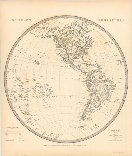
C. Western Hemisphere, (12.8 x 13.2"). The boundary between the United States and Canada is based on British claims in the Northwest, and the present-day Southwestern states are controlled by Mexico. Matched pair with Eastern Hemisphere engraved by J. & C. Walker.
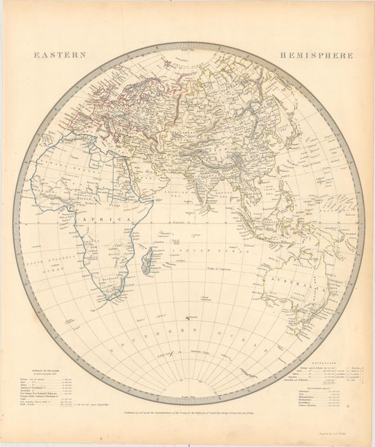
D. Eastern Hemisphere, (12.8 x 13.2"). Africa and Australia show practically no detail in their interiors. Some of the islands around Antarctica are beginning to appear. Matched pair with Western Hemisphere engraved by J. & C. Walker.
References:
Condition: B+
Original outline color with light scattered foxing and minor toning along sheet edges.