Subject: Florida
Period: 1846 (dated)
Publication:
Color: Black & White
Size:
40 x 41.8 inches
101.6 x 106.2 cm
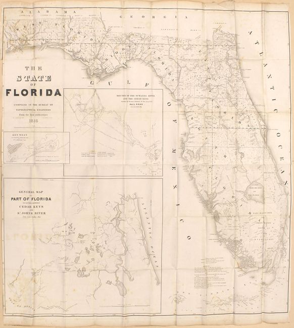
A very large and comprehensive map of Florida showing the status of Public Land Surveys, rivers, lakes, coastal islands, towns, army posts, trails, etc. Inset maps: "Key West as surveyed February 1829"; "Mouths of Swanee R. and Cedar Keys showing the Western terminus of a proposed railroad"; and "A General Map of part of Florida included between Cedar Keys and St. John's River." This incredible chart is filled with detail. Drawn by J. Goldsborough Bruff and finely engraved by D. McClelland of the Topographical Engineers.
References: Phillips (Maps) p. 284.
Condition: B
Issued folding with loss of neatline at left due to the binding trim. A short binding tear enters 0.5" into the image and a 1.5" edge tear at left has been closed on verso with archival tape. Scattered foxing and light offsetting.