Subject: Central California
Period: 1849 (circa)
Publication: House Ex. Doc. No. 17, 31st Congress, 1st Session
Color: Black & White
Size:
19.4 x 20.9 inches
49.3 x 53.1 cm
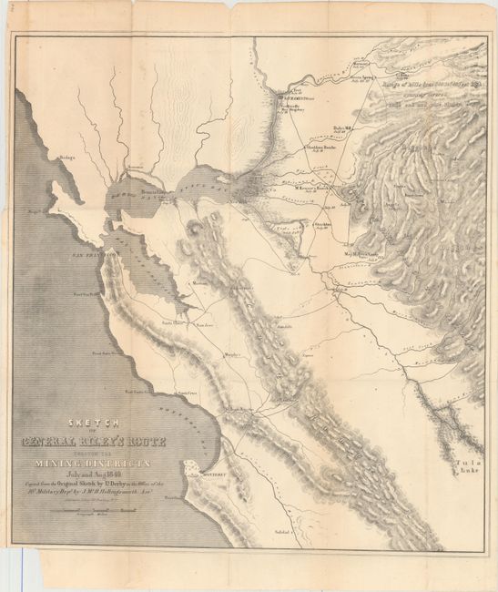
This important and early map of the California Gold Rush was made from Lt. Derby's original sketch by J. Mc. H. Hollingsworth in the office of the 10th Military Dept. It is historically important, not only for its depiction of Gen. Riley's route, but because it names, for the first time, certain actual mining camps in the middle Sierra foothills; Mormon Island (misspelled Mormont), Coloma (mislabeled Colluma), Curtis, Sullivan's, Corons, Jamestown, Woods, and Sonora. The entire route of the Riley party is noted, with the dates of their visits to the various camps, and covers the region from Monterrey Bay, north to Sacramento and east to the gold diggings.
References: Wheat (Gold) #79.
Condition: B+
Issued folding with light toning, minor foxing, and one tiny split at a fold intersection. The bottom left corner of the sheet is trimmed, resulting in a 1" loss of neatline.