Subject: Arkansas, Mississippi & Louisiana
Period: 1845-65 (circa)
Publication:
Color: Hand Color
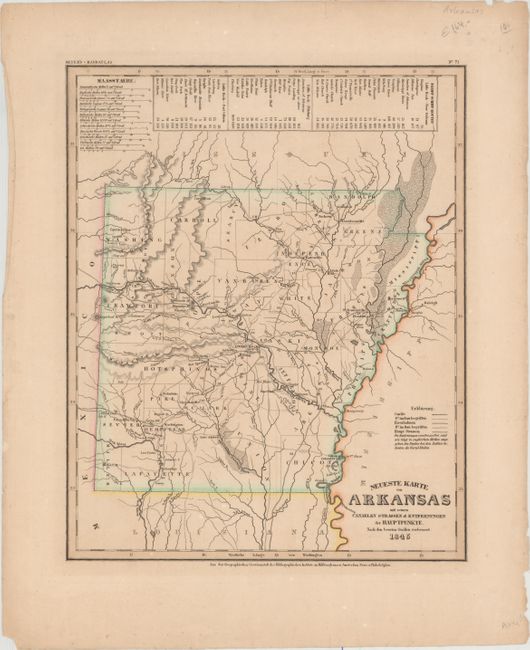
A. Neueste Karte von Arkansas mit Seinen Canaelen Strassen & Entfernungen der Hauptpunkte, nach den Bessten Quellen Verbessert, by Joseph Meyer, from Meyer's Handatlas, dated 1845 (11.8 x 14.6). This early German map of Arkansas shows county configurations just prior to its admittance to statehood in 1836, despite its publication date of 1845. Many counties are only partially delineated. Numerous towns are named, and a number of roads criss-cross the map. The number of miles between towns is helpfully noted, and at the top of the map the steam-boat routes are noted from Little Rock to New Orleans, Pittsburgh, and Fort Gibson. The distance scale includes 12 different scales, to appeal to every nationality. Published by the Hildburghausen Biblio Institut. Condition: Original outline color with light soiling and some short tears confined to the blank margins.
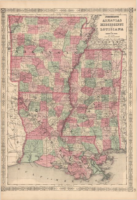
B. Johnson's Arkansas Mississippi and Louisiana, by Johnson & Ward, from Johnson's New Illustrated Family Atlas, circa 1865 (17.5 x 24.2"). A very detailed map of Arkansas, Louisiana and Mississippi published at the end of the Civil War. The map shows county boundaries, numerous place names, roads and railroads. Surrounded by decorative borders with fancy titling. County configuration of Arkansas is current to 1859, prior to the creation of Cross County in 1862. Condition: Original color with a few tiny, unobtrusive spots and light toning along edges of sheet. Narrow left margin, as issued.
References:
Condition: A
See description above.