Subject: Southeast United States
Period: 1806 (dated)
Publication: New Universal Atlas
Color: Hand Color
Size:
20.8 x 18.3 inches
52.8 x 46.5 cm
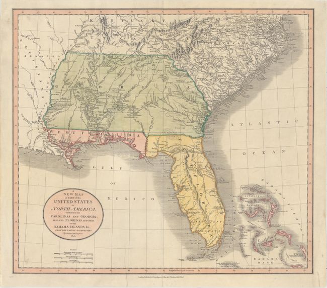
This is a wonderful map of the Southeast issued during a period of rapid change and advancement. East and West Florida exist as separate territories. West Florida was not annexed into the United States until 1810. Portions of it became Louisiana, Alabama and Florida. The map is filled with information on the roads, portages, forts, Indian villages, settlements and topography. It is also remarkable for the many interesting notes, including the Principal Hunting Grounds of the Western Party and Six Villages in Mississippi, here shown as part of the large Georgia Territory. In Florida, Fort St. Marks, Apalacha Fort, and the roads from St. Augustine are shown, with a note that the Apalachees Villages are now almost all deserted. Southern Florida is labeled Ancient Tegesta. A lake and river system connects Mayaco Lake (Lake Okeechobee) with the St. Johns River. The map extends to provide good detail of the Bahamas including a notation on Guanihani or Cat Island that it was the first Land of America Discovered by Columbus - a common misconception of the period.
References: Phillips (Maps) p. 876.
Condition: B+
Nice impression and color on watermarked paper that has been backed with tissue to repair an edge tear that extends 2" into the image at bottom. Minor soiling mostly in the blank margins.