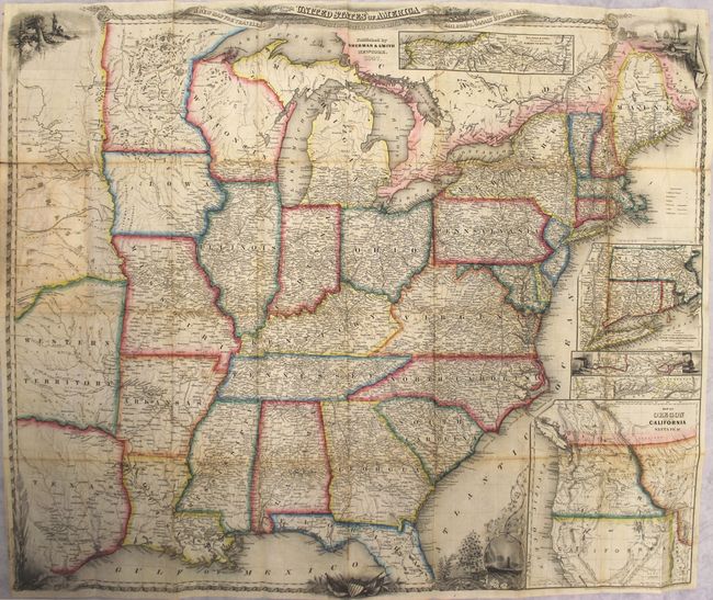
Subject: Eastern United States
Period: 1847 (published)
Publication:
Color: Hand Color
Size:
26 x 22 inches
66 x 55.9 cm
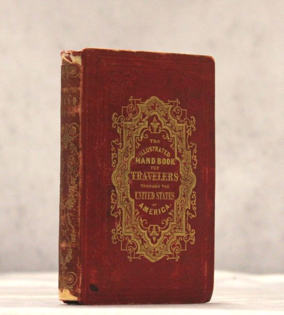
J. Calvin Smith produced some of the best travel guides and maps of the mid-nineteenth century. This wonderful second edition guide contains extensive information for the use of travelers and emigrants during this period of great westward expansion. The folding A New Map for Travelers through the United States of America Showing the Railroads, Canals and Stage Roads (26 x 22") is beautifully engraved with vignettes of Native Americans, a harbor, trains, Niagara Falls and a decorative border. The map shows the eastern United States to beyond the Mississippi River to include Nebraska Territory, Western Territory (Oklahoma) and eastern Texas. The emphasis is on the transportation network, the routes of which are prominently displayed with the distances between points noted. There are several small insets showing important railroad routes, as well as a large inset, "Map of Oregon Northern California, Santa Fe &c," in which the region labeled Santa Fe is included in the Texas panhandle. Published by Sherman & Smith. 233 pages with illustrations throughout. Embossed red cloth covers with gilt titles (4 x 6").
References: Phillips (Maps) p. 899.
Condition: B
The map is lightly toned with numerous short splits at fold intersections mostly closed on verso with archival material. A few separations result in minute loss of image in the New England region. Text is very good with occasional foxing. Binding shows typical wear.