Subject: Western North America
Period: 1797-1820 (circa)
Publication:
Color: Black & White
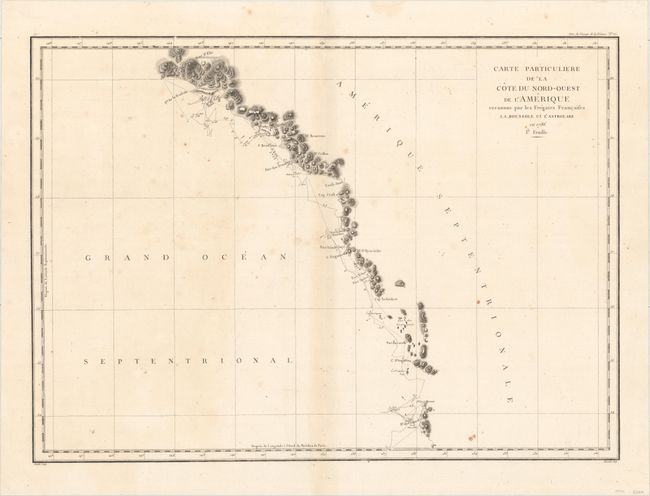
A. Carte Particuliere de la Cote du Nord-Ouest de l'Amerique Reconnue par les Fregates Francaises la Boussole et l'Astrolabe en 1786. 1e. Feuille, by Comte Jean F. Galoup de la Perouse, from Atlas du Voyage de la Perouse, published 1797 (26.9 x 19.5"). This large-scale map of British Columbia and the southeast coast of Alaska depicts the route of the voyage with only those parts actually surveyed from Bay de Clonard (Graham Island) to Mt. St. Elias. Engraved by Bouclet. Ref: Wagner #841; Falk #1797-7. Condition: A dark impression on watermarked paper with scattered foxing. (B+)
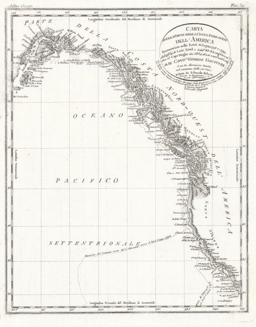
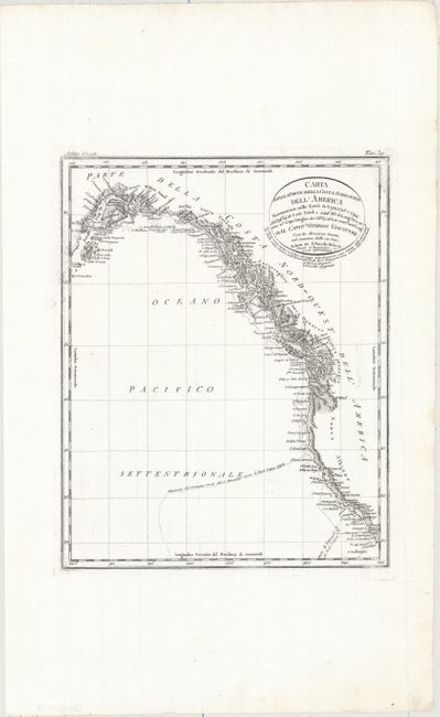
B. Carta della Parte della Costa Nord-Ouest dell' America Riconosciuta nelle Estati del 1792, 1793 e 1794..., by Luigi Rossi, from Atlante Geografico, circa 1820 (8.4 x 10.4"). This very detailed Italian chart is based on the famous Henry Roberts' chart from the Vancouver expedition. It shows the route beginning just south of San Diego, proceeding though Nuova Albione, Nuova Giorgia, Nuova Hanovre, Cornouaglies, Nuova Norfolk, to Cook Inlet and Kodiak Island in Alaska. Large circular title block. Condition: On a clean, bright sheet. (A+)
References:
Condition:
See description above.