Subject: North America
Period: 1829-59 (dated)
Publication:
Color: Hand Color
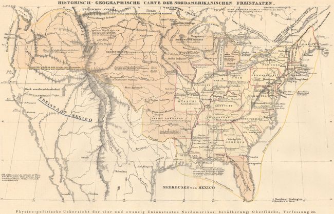
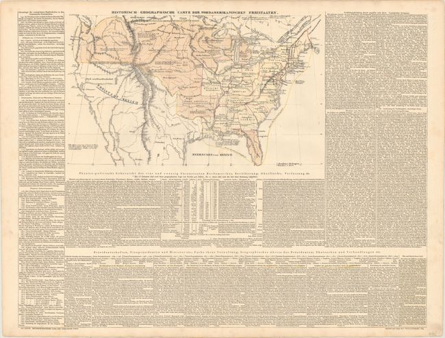
A. Historisch-Geographische Carte der Nordamerikanischen Freistaaten, by Emmanuel Las Cases, from Historisch Genealogisch Geographischer Atlas von le Sage Graf Las Cases…, dated 1829 (16.9 x 9.8"). This map shows the extent of the United States with states colored in yellow and territories in orange. State capitals, cities, towns, Indian tribes, and numerous notations fill the map. On a full sheet of German text (28.6 x 21.8") providing a detailed political history of the United States. Ref: Phillips (Atlases) #3550. Condition: Minor soiling mostly in the blank margins, else fine.
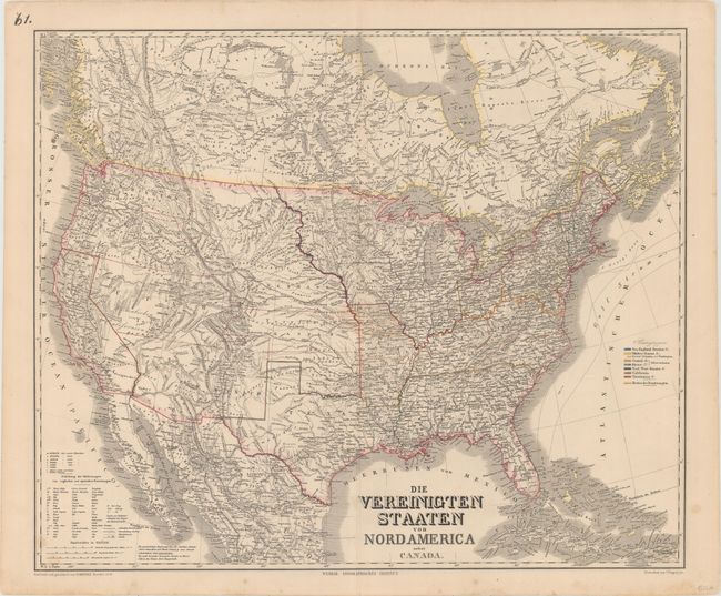
B. Die Vereinigten Staaten von Nordamerica nebst Canada, by Weimar Geographisches Institut, dated 1859 (25.3 x 20.9"). An uncommon, large and very detailed German map issued prior to the outbreak of the Civil War. It covers the United States with parts of Canada and Mexico. This example has a large New Mexico Territory that names the Arizona district, and Utah Territory includes most of Nevada and some of Colorado. The states and territories are shown with superb detail of railroads, rivers, topography and emigrant roads. A color key at right shows the states divided into several regions, including the slave states. Condition: Original outline color with just a few minor spots.
References:
Condition: A
See description above.