Subject: North America
Period: 1755 (dated)
Publication:
Color: Hand Color
Size:
22.9 x 18.8 inches
58.2 x 47.8 cm
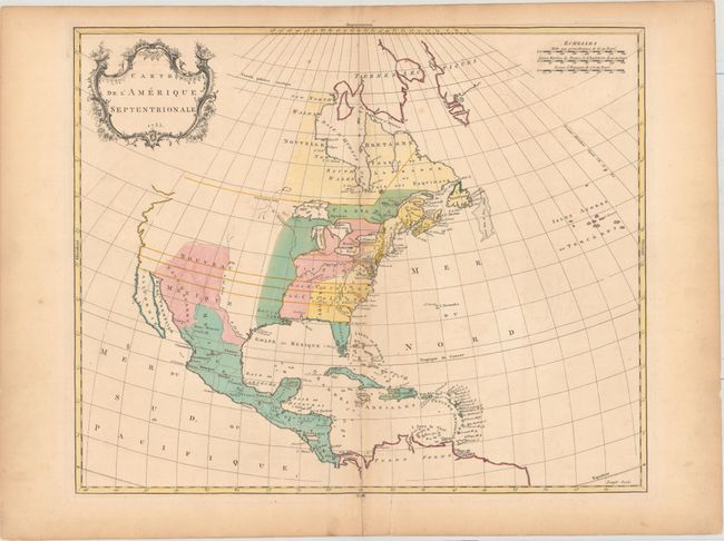
Despite the French text, this is a British map published at the beginning of the French & Indian War, showing British claims extending all the way to the Pacific Ocean. This map differs from Palairet's 1754 map which shows the English colonies confined to the eastern seaboard (but still beyond the Alleghenies). With war appearing imminent, the 1755 edition was clearly intended to justify the British Claims to the Mississippi. The coloring shows the British colonies in yellow, the French colonies in green and the disputed land in pink. Shows only a few place names, the larger rivers and basic topography. Western North America is virtually blank with only the settlement of Santa Fe noted. There is only one dealer listing for this map in the last 30 years.
References: cf. Sellers & Van Ee #16; cf. Phillips (Atlases) #3502.
Condition: B+
Issued on thick, hand-laid paper with faint offsetting and a few minor spots. There is a 3.5" fold separation and 2" edge tear at bottom that have been closed on verso with old paper. Light toning along sheet edges.