Subject: References
Period: 1952-81 (published)
Publication:
Color:
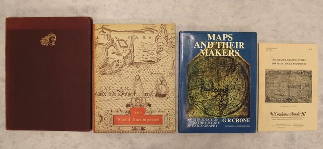
A. Decorative Printed Maps of the 15th to 18th Centuries, by R.A. Skelton, published 1952, printed color (9.6 x 12.5"). First edition of this revised edition of Old Decorative Maps and Charts by A.L. Humphreys. Mr. Skelton was the Superintendent of the Map Room at the British Museum when he published this work. 84 images in color and b/w, 80 text pages. Hardbound in red cloth, titled in gilt on spine with a gilt windhead on the front cover. Condition: Text pages are slightly toned, and there is minor toning along the edges of the illustrated pages. Covers lightly sunned with minor wear. (B+)
B. The World Encompassed - An Exhibition of the History of Maps Held at the Baltimore Museum of Art October 7 to November 23, 1952, by the Trustees of the Walters Art Gallery, published 1952, black & white (9.1 x 12.0"). This interesting and scarce reference catalog was printed to accompany an exhibition on the history of maps held at the Baltimore Museum of Art in 1952. Pictorial wrappers, paperback. Provides information on over 280 maps with 63 plates. The illustrations are very high quality. One of only 2000 copies printed. Condition: Contents fine with minor wear and some light sunning. (B+)
C. Maps and Their Makers - An Introduction to the History of Cartography 5th Edition, by G.R. Crone, published 1978, black & white (8.5 x 11.2"). This is the fifth edition of this scholarly introduction to the history of cartography by the librarian and map curator of the Royal Geographical Society from 1934 to 1966. Extensively illustrated, 152pp. Hardbound in blue cloth with dust jacket. Condition: Contents fine except for a binding error involving two uncut pages. Covers fine. There are a couple short tears on the dust jacket. (A)
D. The Arader Grading System for Maps, Books and Prints - Catalogue 28, by W. Graham Arader III, published 1981, black & white (7.0 x 10.0"). This uncommon catalogue from W. Graham Arader III includes 98 items from a variety of regions, all of them with descriptive text and many with accompanying black & white illustrations. Paperback with a pictorial front cover. Condition: Contents fine with minor soiling on the covers. (A)
References:
Condition:
See description above.