Subject: Disbound Atlas
Period: 1855 (circa)
Publication: The Universal Pronouncing Dictionary...
Color: Hand Color
Size:
12.8 x 9.8 inches
32.5 x 24.9 cm
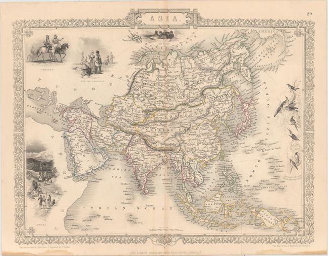
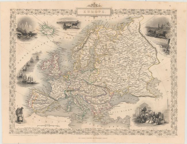
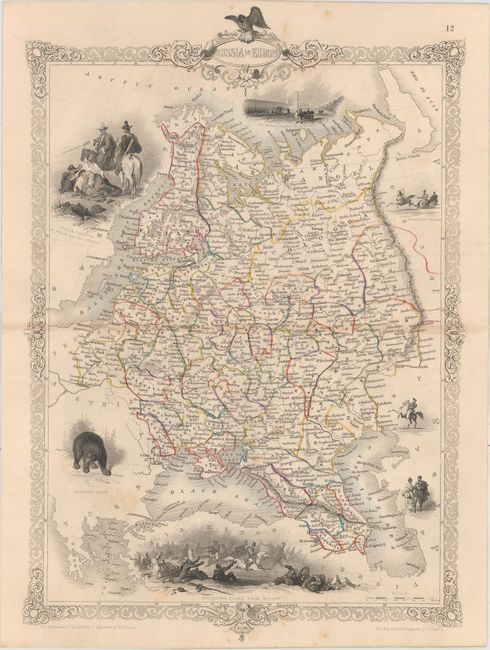
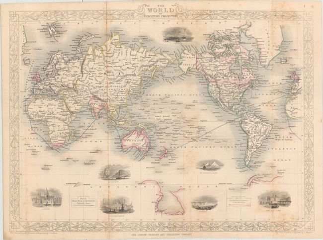
The maps from The Illustrated Atlas were first published in serial form to a target audience that led insular lives due to the expense and hardship of travel. All that changed as the progress of the nineteenth century brought swift and dramatic changes in public awareness of far away places. Tallis' maps no doubt played an important role in this dramatic awakening. These maps not only provided up-to-date geographical knowledge, but also used vignette views within the map's design to show the native people and their occupations, cities and points of interest. The maps hark back to a cartographic tradition from the Dutch mapmakers of the seventeenth century with finely engraved decorative borders. The maps were drawn and engraved by John Rapkin with views drawn and engraved by a number of prominent artists. The maps were issued as a complete volume from 1851 until about 1865. Some of the maps were also published in other history books published by Tallis including British Colonies and, without the vignettes, in geographical dictionaries and encyclopedias until about 1880.
This impressive lot of matching Tallis maps comes from Thomas Wright's The Universal Pronouncing Dictionary, and General Expositor of the English Language. It is nearly complete with 77 (of 81) maps present and is very similar to those found in Tallis’ Illustrated Atlas of the World, including the same distinctive features and style with numerous vignettes and original outline color.
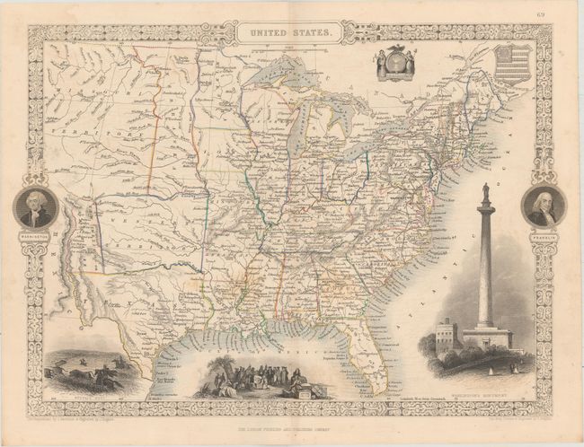
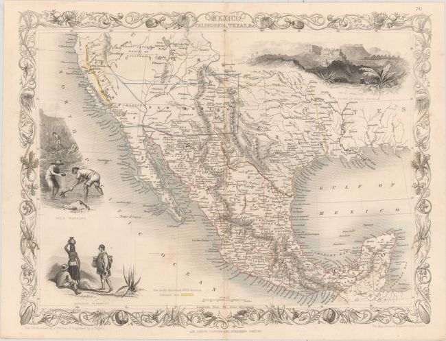
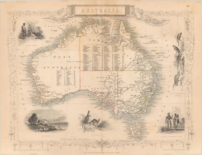
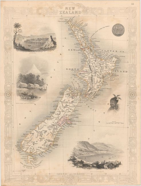
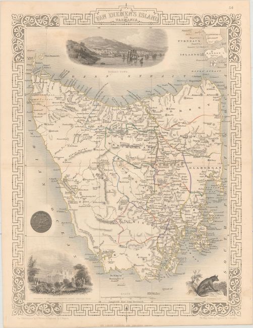
Of particular interest is the map of the United States, which shows early western territorial configurations including a large Western Territory in present-day Oklahoma and Kansas, as well as New Mexico Territory. Curiously, despite the United States' acquisition of California in 1848, New Mexico Territory is shown only as far west as the Rio Grande. Meanwhile, the map of Mexico, California and Texas has been re-engraved to include a vignette of gold panning and the gold regions of California are delineated on the map. In addition to the maps of North America, there are several interesting engravings of Australia including Western Australia, Swan River, Part of South Australia (showing the mining districts), Van Diemen's Island or Tasmania, and New Zealand.
The complete list of maps (size varies slightly) covering all the regions of the world include:
United States
Mexico, California, Texas, &c.
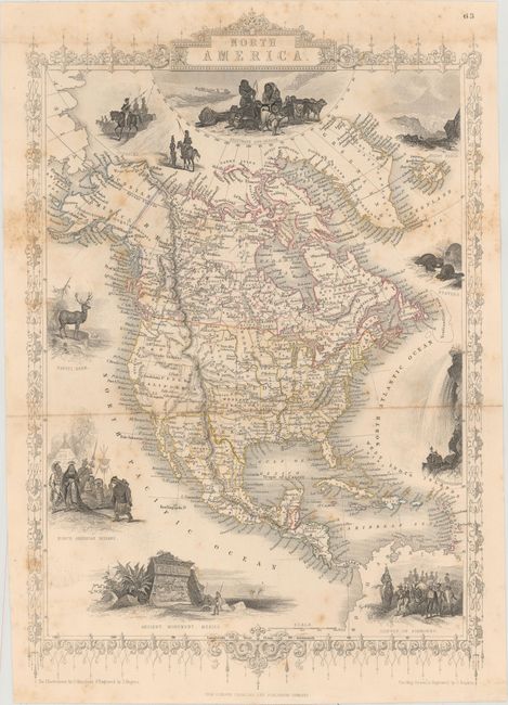
North America (folding)
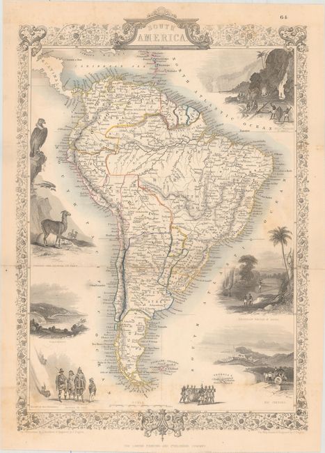
South America (folding)
Australia
New Zealand
Van Diemen's Island or Tasmania
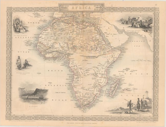
Africa
Asia
Europe
Russia in Europe
World (folding)
Western Africa
British America
Arabia
Asia Minor
Austria
Part of South Australia
Western Australia, Swan River
Belgium
Brazil
West Canada
Cape Colony
China and Burma
Denmark
Egypt, And Arabia Petraea
England and Wales
France
Germany
Greece
Central America
British Guayana
Eastern Hemisphere
Western Hemisphere
Holland
Hungary
Islands in the Indian Ocean
Overland Routes to India
West India Islands
British India
Northern India
Southern India
Ireland
Islands in the Atlantic
Northern Italy
Southern Italy
Jamaica
Japan & Corea
Malay Archipelago, or East India Islands
British Possessions in the Mediterranean
Natal and Kaffraria (folding)
Nova Scotia and Newfoundland
Ancient Palestine
Modern Palestine
Isthmus of Panama
Falkland Islands and Patagonia
Persia
Peru & Bolivia
Plymouth, Devonport and Stonehouse (folding)
Polynesia , or Islands in the Pacific Ocean
Prussia
Cabool, The Punjab and Beloochistan
Russia in Asia
Scotland
Spain and Portugal
Sweden and Norway
Switzerland
Syria
Part of Russia in Asia and Independent Tartary
Thibet, Mongolia, and Mandchouria
Turkey in Europe
Turkey in Asia
Venezuela, New Granada, Equador, and the Guayanas
Victoria, Port Phillip
New South Wales
References:
Condition: B+
Original outline color with maps ranging from good to near fine, with the majority of the maps being very good. There is occasional scattered foxing, light staining, and light offsetting.